

Tonk’s Jai Mundra set a world record with six wickets in the Ireland vs Namibia match
Ireland beat Namibia by 130 runs thanks to Tonk’s Jai Mundra’s brilliant spell of six wickets for 26 runs, making him the best Irish bowler in ODIs
· 1 min read
District · Ajmer division
Politics, administration, crime, education, farming and every local story from Tonk district (Ajmer division).
Ireland beat Namibia by 130 runs thanks to Tonk’s Jai Mundra’s brilliant spell of six wickets for 26 runs, making him the best Irish bowler in ODIs
· 1 min read
The election department has allotted 20 free election symbols to independent candidates for the 2026 Panchayati Raj elections in Tonk, covering items from fruits‑vegetables to household appliances.

Tonk district is a district in Rajasthan, India, with Tonk city as its administrative headquarters. It covers an area of 7,194 km² and had a population of 1,421,326 in 2011.
Tonk district is a district in the western Indian state of Rajasthan. Its administrative headquarters is the city of Tonk, which serves as the central hub for governance and district-level administration.
Geographically, Tonk district is surrounded by several other districts of Rajasthan. To the north it shares a boundary with Jaipur district, while Sawai Madhopur district lies to its east. The southeastern border touches Kota district, and Bundi district is situated directly to the south. On the southwestern side, the district meets Bhilwara district, and Ajmer district lies to its west.
These bordering districts situate Tonk within a network of regional connections, linking it to both the historic capital region of Jaipur and the culturally significant areas of Sawai Madhopur and Ajmer, among others. The district’s location thus places it at a crossroads of various administrative and cultural zones within Rajasthan.
Tonk district lies in the northeastern part of Rajasthan, positioned between 75.19° and 76.16° east longitude and 25.41° and 26.24° north latitude. The district covers a total area of 7,194 km², as recorded in the 2002‑03 survey, and is situated on National Highway 52, about 100 km from the state capital, Jaipur.
The Banas River traverses the district, providing a notable watercourse within its boundaries. Although Tonk is one of the four district headquarters in Rajasthan without a direct railway connection, the nearest railway station, Newai, lies within the district itself, approximately 30 km from the district headquarters.
An unusual geological feature of the district is the Tonk meteorite, a rare carbonaceous chondrite that fell in 1911, adding scientific interest to the region.
The 2011 Census recorded Tonk district’s population at 1,421,326, with a sex ratio of 949 females per 1,000 males and a literacy rate of 62.46 percent. About 22.35 percent of residents lived in urban areas, while Scheduled Castes and Scheduled Tribes comprised 20.26 percent and 12.54 percent of the total population respectively.
Language use in the district is diverse. According to the same census, 36.65 percent of people reported Dhundhari as their mother tongue, closely followed by 29.11 percent who spoke Rajasthani and 29.02 percent who identified Hindi as their first language. Urdu was spoken by 4.12 percent of the population.
These figures illustrate a multilingual community where a majority of inhabitants communicate in regional languages, with a notable proportion also using the national language Hindi and a smaller Urdu‑speaking minority.
Tonk district is organized into nine tehsils: Deoli, Malpura, Newai, Todaraisingh, Tonk, Peeplu, Uniara, Dooni and Nagarfort. These tehsils are further grouped under seven sub‑divisions, namely Deoli, Malpura, Newai, Todaraisingh, Tonk, Peeplu and Aligarh (Uniara). The addition of Dooni as a tehsil is noted in the latest administrative updates.
Within the district, urban local bodies are classified differently. Tonk itself functions as a Nagar‑Parishad, while Deoli, Malpura, Newai, Todaraisingh and Uniara are designated as Nagar‑Palikas, reflecting their municipal status.
According to the 2001 census, the district comprised 1,093 villages, providing a sense of its rural composition alongside the urban centers governed by the various Nagar‑Parishads and Nagar‑Palikas.
Based on: the Wikipedia article (CC BY-SA 4.0) — facts from that source; edited and translated by Times of Rajasthan.
Farm advisory
Sat
31° 18°
0% · 0mm
Sun
32° 18°
0% · 0mm
Mon
31° 17°
0% · 0mm
Tue
30° 18°
0% · 0mm
Weather: Open-Meteo forecast. General advice — ask your Krishi Vigyan Kendra or agriculture supervisor for doses.
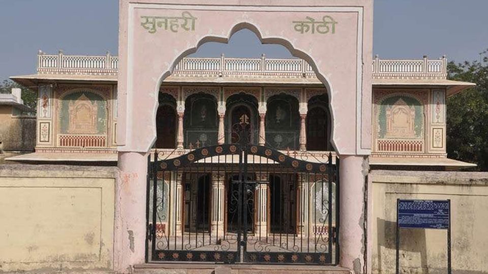 VISUAL STORY · WITH MUSICTonk Darshan▶ Watch & listen
READERS’ POLL
Vote to see the results
A proverb, a word and a district from the land of dunes — every day
PROVERB OF THE DAY
“पाणी पीजे छाण कर, गुरु कीजे जाण कर”
Strain water before you drink it; know a teacher before you follow one.
MARWARI WORD
मनवार
Lovingly insisting a guest eats and drinks a little more
DISTRICT OF THE DAY
Chittorgarh
FAIRS & FESTIVALS
This month: Pushkar Fair, Bundi Utsav
Kumbhalgarh Festival
Rajsamand · December
Discover Rajasthan →
