Kotputli-Behror Darshan — Neemrana Fort Palace, Cement industry
Kotputli‑Behror district in Rajasthan blends heritage sites with vibrant industry.
TIMES of RAJASTHAN · DARSHAN
Kotputli-Behror Darshan — Neemrana Fort Palace, Cement industry
Kotputli‑Behror district in Rajasthan blends heritage sites with vibrant industry.
In detail
Kotputli‑Behror district in north‑eastern Rajasthan was formally created on 7 August 2023, merging parts of Jaipur and Alwar districts. It is bounded by the Aravalli ranges, traversed by the Sahibi River, and comprises eight tehsils with joint headquarters at Behror and Kotputli.
Overview
Kotputli-Behror district is a newly created administrative unit in the state of Rajasthan, India. It was carved out of the former Jaipur and Alwar districts and was formally established on 7 August 2023. The district lies in the north‑eastern part of Rajasthan and is surrounded on three sides by the Aravali Ranges, with the Sabi River flowing through it.
The district is divided into eight tehsils: Kotpulti, Behror, Neemrana, Bansur, Mandhan, Paota, Viratnagar and Narayanpur. The district headquarters are jointly located at Behror and Kotputli, reflecting the dual administrative centers that manage the region.
Historically, the area has significance dating back to the Mauryan period. The Bhabru rock edicts, which mention Piyadasi as the name of Emperor Ashoka, were discovered within the district’s boundaries, indicating its ancient importance.
A substantial portion of the district, comprising the tehsils of Behror, Neemrana, Bansur and Mandhan, is referred to as the Rath Region. Although Mundawar tehsil was once part of this region, it was later incorporated into the separate Khairthal district.
History
In the Sahibi river basin, excavations have uncovered late Harappan period archaeological evidence, indicating that the area now known as Kotputli‑Behror district was part of the wider Matsya Cultural Zone. Viratnagar tehsil, mentioned in ancient Indian texts as the capital of the Matsya Kingdom, is said to have been founded by King Kirata, and the Pandavas are believed to have spent their twelve years of exile in disguise there. The oldest evidence of a Buddhist shrine in a circular pattern was found in Viratnagar, and the region was part of the Mauryan empire, with King Ashoka’s name, Piyadasi, appearing in the Bhabru Rock edicts. Indo‑Greek coins excavated in and around Viratnagar suggest that it was a flourishing trade town under Indo‑Greek rule.
In 1009 AD, the town of Narayanpur tehsil, then a state ruled by a king, was attacked by Mahmud of Ghazni. The state was defeated, the town was plundered to ruins, and its temples were destroyed. The town was later re‑established near limestone hills and became the headquarters of the eponymous Narayanpur Tehsil. During this period, the Tomars and Chouhan rose as power centres, while the northern parts of the district were under the Bhadanka empire. The empire was defeated by Prithviraj Chouhan in the years following 1150 AD, and its hold weakened further after the defeat in the 1192 AD battle of Tarain. After the loss of Delhi, the descendants of the Bhadanka rulers spread into the region called Rath, with chief centres such as Neemrana and Mundawar. This area then came under the rule of the Sultans of Delhi and was administered under Narnaul Suba.
The subsequent years saw a series of chieftainships. Rao Made Chauhan founded the village of Madanpur, now known as Mundawar, and his descendants acquired Barod. Firoz Shah forced Rao Jhama to embrace Islam, but he preferred death. Rao Chand, son of Rao Jhama, converted to Islam in Samvat 1499 (AD 1442). After this, Rao Chand’s uncle Rajdev left Mundawar and chose Neemrana as his capital. Rao Chand’s descendants held power until Bansur, but were expelled by the Shekhawats in Samvat 1560 (AD 1503). Rao Suja made Basai his capital, while Jagmal established himself at Hajipur. After Rao Suja’s death in Samvat 1594 (AD 1537), his sons extended their authority to Khetri, Sikar, Khandela, and Shahpura.
Following Aurangzeb’s death, internal differences allowed smaller chieftains to seize power. Maharaja Surajmal of Bharatpur conquered the Alwar fort and nearby areas, but his son Jawahar Singh was defeated by the Jaipur ruler in the battle of Monda‑Mandoli and lost the territory gained by his father. The Marathas captured Tijara and Kishangarh. In 1775, Pratap Singh of the Naruka family acquired the Alwar fort and established the Alwar State, bringing a major part of the district into its domain. Before British rule, the district was governed by Sultans, Mughals, Marathas, and finally the Alwar Princely State, while Kotputli Tehsil was under the Khetri Princely State.
The Neemuchana massacre, known as the Jallianwala of Rajasthan, occurred on 13–14 May 1925. Landlords (Biswedars) of Bansur revolted against increased taxes imposed by the Alwar king, and the Alwar state army and British army surrounded the village of Neemuchana. The army closed all roads and fired indiscriminately with machine guns, burning the village to ashes. Government figures recorded 156 farmers killed and more than 600 injured, while unofficial accounts claimed up to 1,500 deaths. The incident prompted a strong reaction across the country, and Mahatma Gandhi described it as ‘more vicious than Jallianwala Bagh.’ The Alwar court was forced to withdraw its decision and pay compensation to the next of kin.
Geography and climate
Kotputli-Behror district experiences a predominantly dry deciduous climate, with rainfall concentrated in the months of September and October. Summers are long, hot and dry, often accompanied by frequent hot winds known locally as "lu." Winter temperatures can fall to the freezing point.
The district is traversed by several rivers and watercourses, though it lacks major surface water bodies such as lakes. The Sahibi or Sabi River, originating from the Aravali hills along the district’s boundary with Sikar and Jaipur, is the main and largest river. It is a 300 km long, rain‑fed, episodic river that flows toward Haryana and Delhi before draining into the Yamuna. The Sota River, a tributary of the Sahibi, drains into it near Sotanala in Behror Tehsil. Other smaller streams, such as the Narayanpur Nala, carry drainage from the north‑west of Bansur Tehsil and also join the Sahibi.
Additional watercourses include the Surakh Nala, which originates from the Babariya bund in Bansur and empties into the Sahibi at Sodawas Hajipur, and the Harsora Nala from Bansur that meets the Sahibi at Bijwar in Mundawar Tehsil of Khairthal district. The Ajabgarh Nala (also called Kali Nadi) and Partabgarh Nala begin in Bansur and Thanagazi respectively, and merge into the Banganga stream near Baldeogarh in Jaipur.
The only significant man‑made water body in the district is the Buchara dam on the Sota River, along with the Babariya bund, which together provide limited surface water storage for the region.
People and languages
Kotputli-Behror district, as recorded in the 2011 census, had a population of 1,271,922, with 116,281 people, or 9.14%, residing in urban areas. The religious composition is dominated by Hinduism, while Muslims constitute the main minority group. Language use in the district reflects a blend of local and official tongues. Ahirwati is the most common language spoken in the major parts of the district, and Hindi serves as the official language. The local dialect is heavily influenced by Bangru, giving it a distinct character that can feel rough to those not accustomed to it.
Economy and agriculture
Agriculture contributes a major part of the GDP of Kotputli‑Behror district, with manufacturing following closely behind. The district’s fertile plains support extensive cultivation of mustard and wheat, making the Behror‑Neemrana area a leading producer of these staples. Cotton also plays an important role in the region’s agricultural output.
The district hosts several government‑developed industrial areas, benefitting from its proximity to state capitals and good connectivity. Key industrial clusters include Neemrana RIICO, Neemrana Japanese SEZ, Behror RIICO, Shahjahanpur RIICO, Sotanala RIICO, and Keshwana RIICO. Behror RIICO is the oldest manufacturing cluster in the district, while the Neemrana Japanese Zone and EPIP Zone contribute significantly to the district’s GDP. Industries in Neemrana number around 1,500 and include major players such as Daikin AC, Havells, Hero Bike Plant, Parle‑G Biscuit, and Richlite Biscuit. In Behror, Greenlam Plywood is a major manufacturing unit, and Barmalt operates in Keshwana.
Kotputli hosts a large cement manufacturing and processing unit operated by Aditya Birla Group’s UltraTech Cement. According to the Census of India 2011, the most important commodities manufactured in the district’s towns and cities were cement production, granite tiles, and sunmica in Behror; cotton yarn and electric wire in Neemrana; wooden furniture, textiles, and mustard oil in Shahjahanpur; vanaspati ghee, mustard oil, and grain products in Kotputli; and leather shoes (mojadis) in Viratnagar, though these have changed rapidly in recent years.
The district also features a notable natural resource: the black marble mined in Bhainslana village, known as Bhainslana Marble. This variety of marble has been used in the new Parliament building of India and in the creation of deity figures.
Agricultural markets are well established, with a mandi located in both Kotputli and Behror, facilitating the trade of the region’s primary crops. Additionally, the Jakharana goat, a milch breed originating from Jakhrana village near the Haryana boundary, is a famous local livestock variety that contributes to the district’s agricultural diversity.
Culture, fairs and places to see
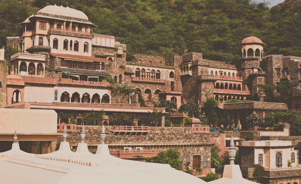
The district’s cultural landscape is punctuated by a number of historic forts and temples that attract visitors throughout the year. Neemrana Fort Complex, dating back to the 16th century, stands as the most prominent landmark in the Neemarna tehsil. Its walls, once occupied by the Chouhans who claimed descent from Prithviraj of Ajmer, have witnessed the region’s history until 1947. Nearby, Bansur Fort rises on a small hillock in the town of Bansur. Built between the late 16th and early 17th centuries, it served as a sentinel on the border between the princely states of Jaipur and Alwar, reflecting the strategic importance of the area during that period. Further south, Taseeng Fort, located in the Aravali hills just five kilometres from Behror headquarters, is a 450‑year‑old heritage site that remains under the stewardship of the Badgujar Rajput clan.
Religious sites also play a central role in the district’s cultural life. The 637‑year‑old Mansa Devi Temple in Dahmi draws devotees from far and wide, especially during Navratri. Baba Khetanath Temple in Joshihera, Neemrana, and the ancient Saroond Mata Temple on a hillock beside the Sota River in Saroond Village are other notable places of worship. Near Barrod of Behror, the Hanuman Temple in Rundh Bardod is situated within a sacred grove, adding to the spiritual tapestry of the region. The Hajipur Fort, constructed under the reign of Mughal Emperor Akbar, was originally intended to protect commercial convoys heading to Alwar from bandit attacks.
Agriculture and livestock also shape the district’s cultural identity. Behror‑Neemrana is a leading producer of mustard, wheat, and cotton, with a local mandi in Kotputli and Behror facilitating trade. The Jakharana goat, a milch breed originating from Jakhrana village near the Haryana boundary, is renowned in the area. Every May, the Rath Cattle Fair in Behror gathers a large number of people to celebrate and improve the Rath breed, underscoring the district’s ongoing connection to its pastoral heritage.
Education and transport
Education in Kotputli-Behror district is supported by a mix of well-known CBSE and RBSE schools, alongside several higher education institutions. Raffles University, NIIT University, St. Margaret Engineering College, a private and government women's college, a co‑education college, multiple B.Ed. colleges, and LBS College are among the notable institutes offering a range of academic programmes. While the district lacks a medical college, the nearest one is situated 120 kilometres away.
The district’s transport infrastructure is dominated by major highways. National Highway 48, one of India’s busiest, crisscrosses the district, linking the two district headquarters and providing direct connections to Jaipur and New Delhi. The Trans Haryana Expressway (NH 152‑D) connects the district headquarters to Chandigarh, and the Paniyala‑Barodameo Expressway, still under construction, will link the district to Alwar, Kairthal, and the Delhi‑Mumbai Expressway.
Rail connectivity is limited, with no full railway line traversing the district except a short strip in Kathuwas of Mandhan Tehsil. The nearest railway stations are Narnaul on the Rewari‑Phulera line and Bawal on the Rewari‑Alwar line. An inland container depot is located at Kathuwas on the Rewari‑Phulera railway line.
Air transport access includes two international airports—Indira Gandhi International Airport and Jaipur International Airport—each about 120 kilometres from Behror headquarters. A domestic airstrip, Bachhod Airstrip, lies 25 kilometres from Behror and 50 kilometres from Kotputli headquarters.
The district also hosts the Maharana Pratap Regional Training Centre (MPRTC) of the Central Industrial Security Force on the Behror‑Narnaul state highway. Established in 2010, the centre conducts basic training for new recruits and various in‑service specialised courses.
Rajasthan’s first integrated public health laboratory was inaugurated in the PBDM hospital in Kotputli on 22 June 2023 with support from the CDC, further enhancing the district’s healthcare infrastructure.
Based on: the Wikipedia article (CC BY-SA 4.0) — facts from that source; edited and translated by Times of Rajasthan.
More visual stories
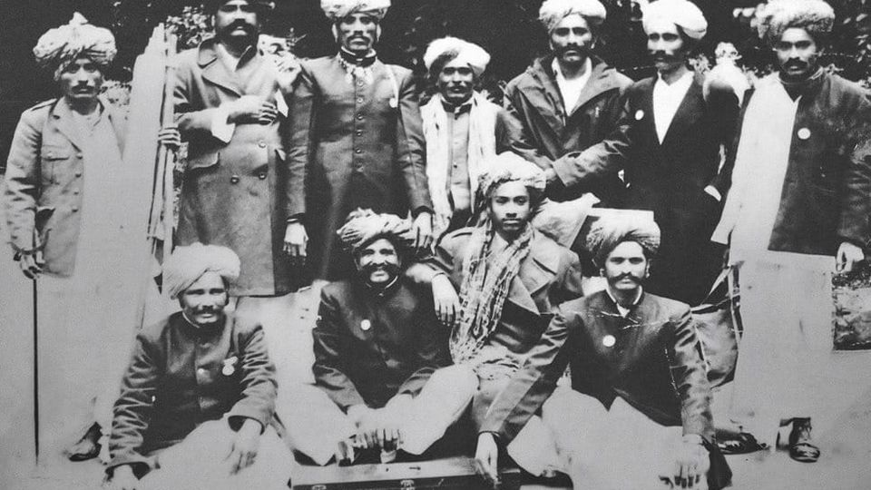 Folk musicKesariya Balam — the songs of the ManganiyarsMaand singing from the Thar, the hum of the kamaicha and the clack of the khartal.5 scenes · with music · ♥ 11
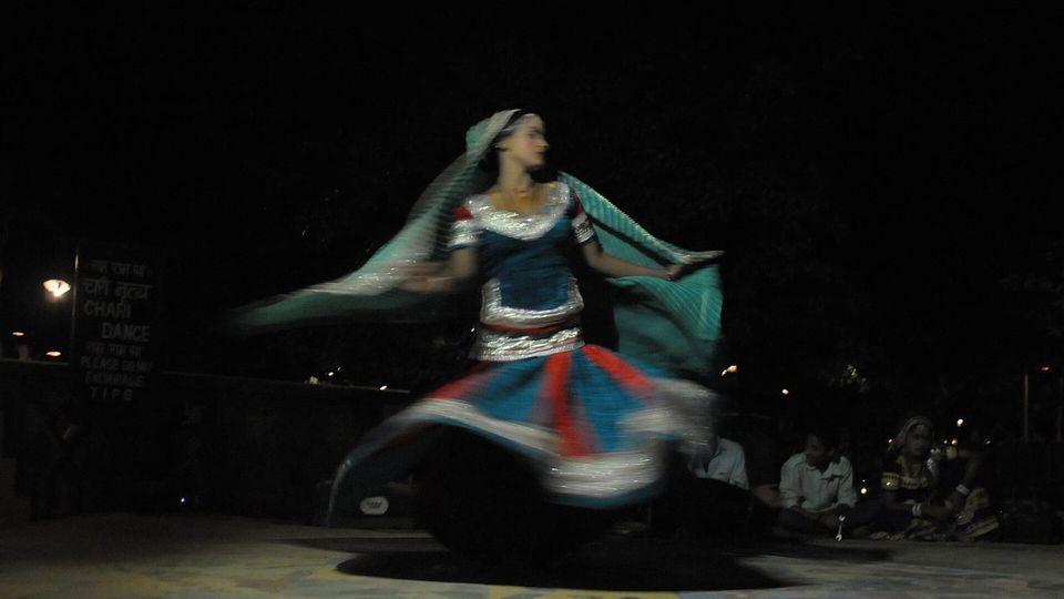 Folk danceGhoomar — the dance of the swirling skirtSwirling ghagras, flowing veils and clapping rhythms at Gangaur, Teej and weddings.3 scenes · with music · ♥ 13
 Folk danceKalbeliya — the serpent dance, a UNESCO heritageBodies sway like serpents to the pungi; on UNESCO’s intangible heritage list since 2010.4 scenes · with music · ♥ 1
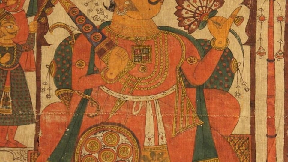 PaintingPhad and Ravanahatha — a story that travelsThrough the night, the bhopa and bhopi sing the epic of folk deities before the phad, to the ravanahatha.4 scenes · with music · ♥ 5